International Sister Cities
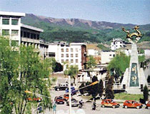
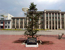
Helong, China
Homepage
Location
Located at the east of Jilin Province (吉林省) of China and northeast of Baekdusan Mountain; promoted to a city in 1993
Transportation
- Flight between Incheon – Yanji, Changchun, Shenyang, Harbin, Mudanjang, and Dairen
- 50 minutes from Yanji by car
Area
5,069 ㎢
Population
220,000 people (55% ethnic Koreans living in China)
Administrative District
4 offices, 10 Zhens, 5 Xiangs, and 159 Cuns
Climate
Annual average temperature of 5.1 ℃; annual precipitation of 553mm
Features
- The first ecological pilot district
- Major indistries: Agriculture (rice, bean, corn, unhulled rice, leaf tobacco, apple, pear, etc.), forestry (wood processing), mining, and industry (building materials)
- Main resources: copper, gold, silver, coal, marble, limestone, etc.
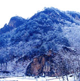
Major Attractions
Mount Song, river head of Dumangang River, Xianjingtai, Juncho, Diaoyutai State Guesthouse, etc.
Festivals
Azalea Festival (Every April)
Living Environment
Voltage 220V (three phase), frequency 50Hz
Yanbian Korean Autonomous Prefecture
“The largest autonomous province of ethnic Koreans living in China; the only autonomous province of a minority race in the Northeastern region”
- Establishment: September 3, 1952
- Area: 42,700 ㎢
- Population: 2.18 million people (820,000 Korean Chinese people - 37.7%)
- Administrative district: 6 cities, and 2 counties
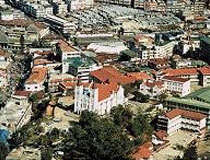
Baguio, Philippines
Homepage
Location
Located in Benguet, Luzon, Philippines; 250 km to the north of Manila; average elevation of 1,500 m; and promoted to a city in 1908
Transportation
Flight (Incheon – Ninoy Aquino International Airport – Domestic – Baguio Loakan Airport / Incheon – Clark International Airport – land), 3 national roads route
Area
57.5㎢
Population
350,000 people (7,000 overseas Koreans)
Language
Official languages include Ilokano, Tagalog, and English
Administrative District
128 Barangays, and 20 administrative districts
Climate
Annual average temperature of 20℃; monsoon season during June – August with rain at least once a day
Feature
- Built as a vacation spot of the USA; and has a golf course with 100 years of history
- Reconstructed after the second World War and the big earthquake in July 1990
- Called as a summer capital city, a city of education, a city of pine trees, and a city of garden
- It has a temperate climate due to its geographical feature of being in alpine zone, and even if the Philippines is composed of tropical regions, the city of Baguio has temperate climate.
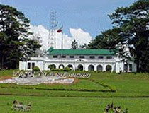
- Located in the city of Baguio are the Mansion House and The Philippines Military Academy
- Educational Facilities: 8 Universities, 37 Vocational Schools, 43 Middle Schools (public) and Private Schools, and 66 Elementary Schools
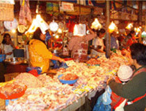
Key Industries
Retail Business 50%, Real Estate Rental and Accommodation 14%, and Service 12%
Major Attractions
Golf courses (2 courses), Burnham Park, Mines View Park, Mansion House, Baguio Cathedral, and natural cave at Mount Pulag (2,930 m)
Festivals
Baguio Panagbenga Festival (during February of every year), and Baguio Day (every September 1)