Riverhead of the 3 Rivers
Geomnyongso Spring

Inquiry
Taekbaeksan National Park 033)550-0000
Location
San 1-1, Changjuk-dong, Taebaek-si
Introduction
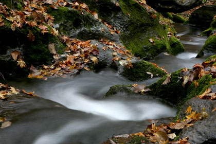
This riverhead of the Hangang River is located by the Geumdaebonggol Valley in Changjuk-dong. Water from Jedanggumsaem Spring and Gomoknamusaem Spring by the bank of Geumdaebong and Mulgunyeong Seokgansu (spring water from rock crack) of Mulgol Valley as well as Yeteogum sinks into underground and surges out again at Geomnyongso Spring to become the riverhead of Hangang River of 514km length. In 1987, it was officially approved as the longest riverhead by the National Geographic Information Institute as the result of roadbed survey. Geomnyongso Spring, which has the circumference of about 20m and unknown depth, spurs out 2-3 thousand tons of underground water through the limestone rocks. Because of long years of streaming, there is a bedrock of 1m - 1.5 m in depth and 1m - 2m in length where the water flows down, reminding the belching of a dragon.
According to the legend, a monster serpent that lived in the West Sea swam against the Hangang River to become a dragon and reached here to find the farthest pond of all. The monster serpent realized that his is the farthest pond of all and trained here to become a dragon. And this bedrock is the trace of the monster serpent trying to enter the pond.
The water of Geomnyongso Spring is maintained at 9℃ all year around, and blue moss on the surrounding rocks create a mystic atmosphere.
This water flows down to Goljicheon Stream and Joyanggang River of Jeongseon, Donggang River of Yeongwol, Danyang, Chungju, and Yeoju; joins at Yangsu-ri, Geyonggi-do; and again joins Imjingang River to flow into the West Sea. On the 1st Sunday of every August, Hangang Daeje (Village Ritual) is held by Hwangjisisangrokhoe.
Samsuryeong Pass

Inquiry
Taebaek Tourism and Culture Department 033)550-2083
Location
135, Hwajeon-dong, Taebaek-si (Jeokgak-dong)
Introduction
You can meet the hill with the elevation of 920m as you head to Samcheok along the National Road No. 35 from Taebaek, and this hill becomes the watershed of Hangang River, Nakdonggang River, and Osipcheon Stream.
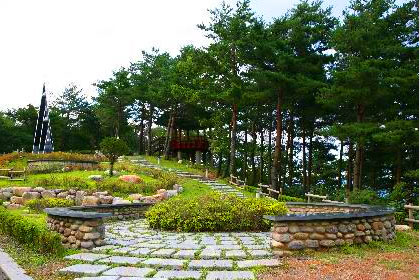
It is called Samsuryeong Pass because raindrops here flow into the Yellow Sea along Hangang River, the South Sea along Nakdonggang River, and the East Sea along Osipcheon Stream. There are sculptures and T-shaped house at the summit. And on the opposite side of Samsuryeong Pass, the Maebongsan Wind Plant (Windy Hill) and the starting point of the Nakdong Ridgeline are located.
Samsuryeong Pass is also called Pijae Pass, meaning an escaping hill, because the people from Samcheok thought the Hwangji area was “utopia” and fled to this place to escape wars.
Hwangji Pond

Inquiry
Taebaek Urban Transport Department: 033)550-2131
Location
25-2, Hwangji-dong, Taebaek-si
Introduction
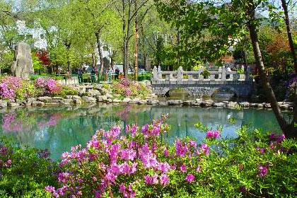
Hwangji Pond is the riverhead of the Nakdonggang River with the length of 1300 li (about 520 km), which is located at the center of Taebaek. The water from this pond flows through the wide Yeongnam Plain. It is divided into big pond with 100m circumference, medium, and small pond. 5,000 tons of water spurs out each day.
According to the legend, the pond is called Hwangji because the site of rich Mr. Hwang became the pond. But it used to be called Cheonhwang way before that, meaning the pond of sky. The legend of rich Mr. Hwang is about Mr. Hwang who gave a scoop of cow dung to an old Buddhist monk when he asked for donation. The daughter-in-law who saw this apologized for Mr. Hwang and donated rice to the monk. “The luck of this house ends here and there will be a big accident soon. Follow me if you want to live. Do not look back no matter what,” the monk said. She followed the monk but she forgot about monk’s saying and turned back when she heard a loud thundrous noise when she reached the ridge of Gusa-ri, Dogye-eup. Mr. Hwang’s house sank into the ground and became a big pond and he turned into a monster serpent. The daughter-in-law turned into a rock and it looks as if she is carrying a baby on her back. The site became 3 ponds. The big bond is the house, the medium pond is the mill, and the small pond is the toilet.
